The Indian Railway Privatisation Debate
"Privatisation" here does not mean what you think it does
The heading of this chapter is not “Should Indian Railways allow privatisation?” not just because according to a popular writing trope the answer to any heading that is a question should be “No“, but because there is no definite answer to such a question. The debate on Indian Railways’ privatisation has been raging ever since the globalisation of the Indian economy in the 1990s. Even when most of Indian industrial, commercial and economic landscapes and with it the Indian mindscape have transformed unrecognisably in the three decades following that event, the Indian Railways stubbornly refused to change, continuing to exist in its bubble as a running time warp and relic of the great Indian socialist noon of the 1970s. But now, things are finally changing. In what could be the greatest-ever tectonic shift in the Indian surface transportation scene since a multitude of private and British-owned railway companies were absorbed by the Government of India to create the Indian Railways in 1950, the second NDA government under PM Narendra Modi and RM Piyush Goyal are introducing after a gap of 72 years, privately owned and operated passenger trains in India. Yes, the railways in India are going to see private participation in its core service area, something absolutely nobody really ever thought would actually happen.
The country has already seen its first non-Indian Railways operated train, the 82501/2 Tejas Express between Lucknow and Delhi. To follow up the government has already published a list of routes, all of them top-grossing, no wonder there, to be allocated to private operators to run trains. This is definitely pathbreaking and will more than that without doubt benefit the market and a set of customers. However, there seem to be a lack of an objective analysis about this. What will this move entail? What will the result be? How will it really turn out to be? How will it affect the Indian Railways and the general Indian travelling public? And what exactly is this “private trains” really? Are we “privatising” Indian Railway?
What is “Privatisation” here?
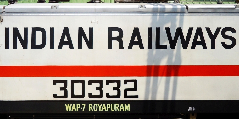
There seems to be a lot of misunderstanding and confusion around the word “privatisation” here, because people think that either they are going to sell off everything including land, tracks, stations, signalling, command and control, operations, all other assets including infrastructure and other things. or that all train operations will be divest to public players. Both are wrong. This is not just because the sheer gargantuan size of the railways makes it impossible to put a price on it, or finding enough opeerators to run 15000+ trains everyday is equally impossible but it is simply not straightforwardly possible to privatise Indian Railways in the conventional meaning of the term. The entity that we know as The Indian Railways is not a company, corporation, PSU or society. It issues no shares, has no chief executive or corporate reporting structure, does no bookkeeping, publishes no profit or loss statements, and directly owns no assets or takes on any liabilities. The Indian Railway is an departmental hierarchy under the Ministry of Railways, Government of India that operates the collective system of railway transport in India as an absolute monopoly operating on a super-centralised command-and-control model obeying no market rules. Trying to privatise Indian Railways will be like trying to privatise the Navy. But unlike the armed forces, Indian Railways operates in an interactive public sphere offering a monetisable public service, which allows competition. The privatisation that everyone talks about, is actually this. As per policy, and as how ministers and the government have repeatedly assured, the Indian Railways will continue to operate and run trains but will be joined by private operators who will run their own services. NOTE: No policies seem to have been fixed yet, so all this is speculation as of now.
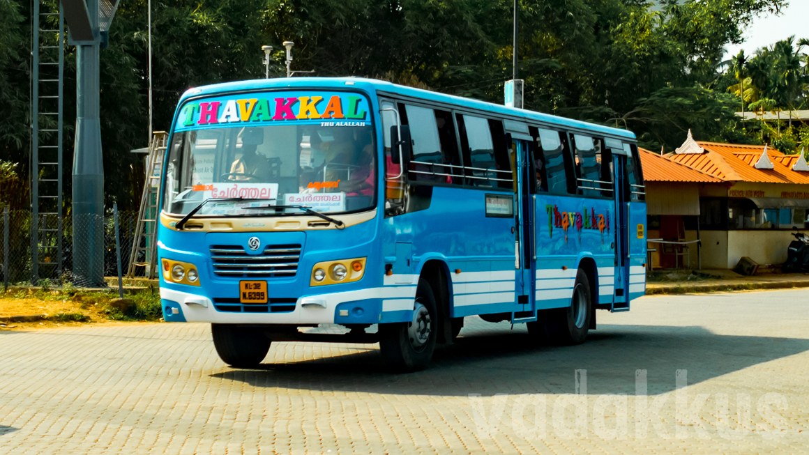
India always had “private” buses owned by individuals, families, companies or societies running services on local, town, city or interstate routes alongside state transport units (SRTCs) on government-issued permits and fares. More recently, we have seen “private” airlines from Jet and Kingfisher to Spicejet and Indigo operating flights after paying airport landing fees. This is what is being replicated in the railway sector. The Indian government is allowing non-governmental operators to run train services on the Indian Railways national network after paying access charges. These “private train operators” will run their own trains alongside “government” trains utilising the the network, tracks, signalling, stations etc. which will remain in the hands of the government. They may use their own equipment (trains/”rakes”) with their own amenities, staff and services and (maybe) also decide the fares and sell tickets to run trains on “time slots” allocated by the Indian Railways/Government. The government (Indian Railways) will decide on policies and regulations and appoint a regulator to ensure things work (fairly) well. This is called the “open access” model and is presently working very successfully in Europe. Please note, this is very different from the franchise model of the UK, where specific routes are allocated as monopolies to train operating companies.
So, just like we have different brands of bus operators and airlines, we will have trains as well, with variously branded equipment, products, services and fares, all tailored to specific passenger requirements in their areas of service. Just like you choose from different buses on RedBus, you could probably choose from different trains on IRCTC. But the similarity ends there as railways’ have a major differentiating factor compared to other transportation media. You can have 20 buses departing Chennai for Hyderabad at 1730 or 10 flights departing Mumbai airport in 10 minutes. But this is not possible for trains. Its fixed right of way limits operations to a singular (one-at-a-time) unit within any given time frame interval, or, a train to run needs a real, physical gap in both space and time that is occupied by nothing else. These space-time based infrastructure sets (continuously vacant block sections) to run trains between destinations on a given time table called time slots or train paths. These paths are the most valuable assets of a railway network owner as rush time slots will invariably fetch huge revenues. For instance, a 1715 slot departure out of Mumbai CSTM towards Pune or a 2000 departure slot from Bangalore to Ernakulam or a 0600 slot from Dhanbad towards Kolkata are all priceless. What Indian Railway is going to offer is not tangible assets but these slots on rent for which operators will pay top rupee. In other words, the government is monetising the railway network.
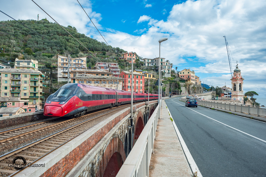
This is how open access operators model looks like in Europe. Trenitalia, DB and ‘B’ are all government owned, while (NTV) Italo, Flixtrain and Thalys are private train operators. As you can see, speeds and prices between government and private operators are comparable.


Ticket prices courtesy The Train Line
It is hence technically more accurate to call this the renting out of running slots rather than privatisation of trains/railways. It turns out it is easier and more profitable to just lease out tracks to run trains than actually running trains.
Introducing private trains in India
The railways were probably the only major economic sector that was left completely untouched during India’s economic liberalisation processes. Even banking and oil and gas were allowed private investment and participation. However, on hindsight, that was a prudent decision. India at that time couldn’t have afforded private rail transport, not the passengers or operators. This has now changed. Railway operations have now become feasible for private operators and affordable by customers alike. There are today increasing numbers of Indians willing to pay a premium to travel comfortably, and this is not just the super rich. Ordinary daily commuters in Kerala protesting against late-running of trains in the state when reminded that “fares are low”, replied that they value time more than money. Thiruvananthapuram (TVC) is the only railway division that sells unreserved tickets over the counter for short-distance travel in Sleeper class coaches. And this is now spilling over to AC classes as well. Atleast in Kerala, private trains, if they run on time and maintain a basic level of passenger-friendly service, will be massive, runaway successes. The second thing that has changed is the improvement in infrastructure.
Indian Railways was founded with the objective of providing easy connectivity for national integration. To meet this end it had to provide services at near-to-nothing fares, which necessitated a monopoly at the mercy of government funding, leading to stagnating growth and no infrastructural growth. There was no question of any private investment with this model. But over the past ten years, Indian railway infrastructure has massively improved (except in some corners like Kerala). New and better tracks, signalling and stations have resulted in improved speed and running times as many trunk routes now support 130 kph and some even 160 kph. It won’t be long before Mumbai-Delhi will be a 11-12 hour journey. However, the biggest game changer has been the Dedicated Freight Corridors (DFC) which will solve the biggest infrastructural and operational discrepancy on the Indian Railways. Until now, both freight and passenger trains using the same tracks lead to rapid track degradation, massive traffic congestion, and both slow (and late) passenger trains and uncompetitive freight business. As the DFCs are being commissioned in the next few years, freight traffic will completely vacate the busiest (and most lucrative) passenger corridors, freeing up capacity in the numbers of tens of slots every day for fast trains to fly on free and open tracks which can be auctioned for private operators to run trains.
In fact, this makes sense. Currently it is impossible to determine how much profit/loss a train makes because one would have to factor in sunken costs (of building and maintaining the network) and a thousand other things and not just running costs alone. Since it is not possible to determine returns, it also becomes extremely difficult to calculate how much money to invest in improving passenger experiences and so on. This is why despite throwing endless amounts of cash at it, railway services seem to never improve. The liability of the operator will be limited to access fees the infrastructure remains with the government. Equipment (rakes) can be leased, staff can be hired, yard and maintenance facilities can be leased. The operator will know exactly how much to spend, where to spend and what it gets in return. More than anything, the passenger gets travelling options according to their requirements and not a centralised system forced upon them. However, it goes without saying that none of this will be effected if the government ensures a well-regulated, level-playing field for many operators, which is crucial. The private-railway industry must be regulated as much as the airline industry is.
Those who equate private trains with private buses and try to draw parallels should realise that the latter is a completely unregulated service model operating outside the law by bending it with no provision for legal consumer recourse. And even after their wanton harassment after all these decades, they are still alive and thriving. Even after allegations of one operator beating up their passengers in Kerala, the buses are still running and running full. This is because there is a demand for their services. This is purely a problem of absence of regulation. The private-bus business must also be regulated as much as the airline industry is.
What About Indian Railways?
All this is fine. What would be the fate of the Indian Railways? A lot of people seem to be lamenting predicting the imminent demise of the Indian railway system. It would be hardly that. Anyone living in India and travels by its trains very well know how so very intertwined life in this country is with its railways, and how so absolutely dependent a large huge majority of its population is on it for their travelling needs. The plan is to allow access to 150 private trains on the Indian Railways network by the year 2023. Even then, private trains will constitute just a buffer shy of 1% of all Indian trains making them still just a pale blue dot in the Universe of Indian train transport. Running close to 15000 trains, the Indian Railways behemoth will continue to exercise a near-monopolistic iron grip on Indian rail transport. It will be practically impossible to hand over a network of 66000 km to private operators to run, the regulatory hassles itself will be unbelievably complex. It would also come at a cost much, much larger than whatever profits it could ever bring. Indian Railways will continue to be king.
India is still a relatively poor country, despite it having a lot of rich people, and a large mass of these people have nothing but the good old Indian Railways to get them around the country. As you can derive from the paragraph above, there is a reason why Indian Railways exists and it operates as a financially unaccountable entity. This is because like all public transport, it serves a higher purpose, which in this case is acting as the lubricant to the nation by allowing frictionless exchange of people, ideas and commerce throughout its borders. If lubrication of the machine stops, it will jam, seize and grind to a half. Not everything has to be for-profit. Things like medicare, basic education and transport should always be subsidised because these are what grows civilisation. They enable access, integration, commerce and a thousand other things that are much more important than plain-vanilla profit. The Indian Railway will remain the cheapest option for the large masses of this country as it has always existed, the dynamics of the country dictate it. The machine will not work without its lubricant. The Indian Railways is the lifeline of the nation and will always remain so. But still, change is inevitable, and has to be effected to shake up decades of inertia. Of course, there is a lot of opposition to even this proposal, but funnily enough, most of it is raised by people who never even travel by train.
So, what exactly will change with the widespread introduction of private trains in India? When asked, the readymade answer is always, that prices will increase and service will improve. While this could seen plausible at first sight, it might exactly well be the case. These things will not result in direct cause-and-effect, but rather about how the overall character of the service and its attitudes change. Prices may or may not increase, and customer service might most certainly remain poor. What will change is, however, the intangibles, the place of the passenger in decision making processes and how railway services are run in India. At the same time, it is also nearly impossible for private railways to take over Indian Railways like how private telcos undercut BSNL or private airlines outmuscled Air India. We will look at all these in the next chapter.