Public Transit

A Conceptual Dream For a Real Bangalore Metro Network

Bangalore. Bengaluru. The once literally and figuratively cool Garden City/City of Lakes/pensioner’s paradise has become an unlivable horror today, degraded into a frenzy mass of concrete, vehicles, dust, heat and garbage. This story that has been said, told and chronicled a million times and more, of dust, pollution, congestion, garbage, soaring living costs, toxic lakes, water shortage, health problems of its populace and etcetera. And at the bottom of most of these problems lie the insistence of its population on using personal, four-wheeled motorized means of transportation for their daily commuting needs, clogging up the notoriously narrow pathways of their erstwhile colonial city, laid when the primary means of personal transportation was a living creature of four legs, and not a metal contraption of four wheels. This insistence has created a situation where the number of vehicles far outnumber the amount of road they can run on, creating what is called “traffic congestion”. Today it takes an average of one hour or more to travel 10 kilometers, or even more if you dare to tread anywhere near those hallowed locations servicing Bangalore’s world famous bit-and-byte development initiatives. The resulting outrages are mainly manifested through innumerable angry tweets, Facebook and blog posts and articles, mostly by the legendary freshly liberated corporate yuppie Indian complaining about “traffic”, but never about the traffic that he/she themselves create, the elephant in their own cubicles.

Today, everyone in the world except this class, who consider the motorized four-wheeled metal contraption mankind’s greatest invention and the epitome of all kinds of personal greatness, who propose wider roads, new roads, flyovers, underpasses and more of such asphaltic miracles as solutions for traffic problems which only seem to be more aimed towards satiating their car driving cravings rather than solving traffic problems, have realized that we cannot build our way out of traffic jams. More roads will lead only to more cars in an endless cycle of more traffic, more congestion, pollution, wastage of everything from time, money, health and such. Six months after you widen a road you will face double traffic on it. Build a flyover, and you will get traffic jams on and below it. So how do we solve this traffic problem? Public transport? Yes. Public Transport the Indian way? No. When one says “Public Transport”, most people in India today will think Metro trains, which are seen as some kind of magic wand that will solve traffic problems in one stroke. This is also exactly what people in Bangalore wish to believe, that all traffic will magically disappear from its roads the day the Bangalore Metro network is completed. In fact, most people in Bangalore wait for the Metro to be completed not because they can use it to travel, but because they think it will reduce traffic on roads so that they can drive more easily. Nope. Sorry to bake your noodle, but if you are expecting the Metro to magically solve Bangalore’s traffic problems, that ain’t gonna happen. Why?

(If you are reading this on a mobile device, it is recommended that you Bookmark or Pocket this page and later read it on a PC/Laptop to enjoy the full experience of the large images and maps. Thanks! :))

This is what the Bangalore Metro network is proposed to look when it is completed by God knows when.

Namma_Metro_Phase_II_Line_Map (1)

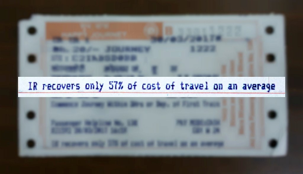
This puny system of 4 and a half lines won’t put a dent in Bangalore’s traffic even the size of an average dent on an average Bangalore car. What it might do is take away some of BMTC’s earnings and nothing more. Though the proposed Bangalore “Namma” Metro network when completed (whenever that happens) might run filled to capacity, there will certainly be no reduction in the number private vehicles on Bangalore Roads. This is because the Metro as designed here is too unconnected, too linear and has a catchment area which is not even one percent of all of Bangalore’s population as you can see from all the yawning gaps between lines in the Google Map above. 75 km of line for a city of a crore people? Riders of the Bangalore Metro will be mainly people who now take BMTC buses, autorickshaws and taxis and also of course, transit passengers to/from the three major railway stations. The average private car driving guy who wants “other” traffic off the roads so that he can drive in peace will not take it, and it does not make any sense to him because it will be too much of a hassle. Surely, there will be private car owners those who really do not want to drive their own cars, but they will still have to drive the Metro stations which will then soon run out of parking space. Even on the Mysore Road-Majestic-KR Puram-Whitefield stretch if ten thousand people ditch their cars, they will only be replaced by vehicles from other areas which the Bangalore Metro network doesn’t serve.

Unless every single area in Bangalore is connected by Metro rail lines, there won’t be any reduction in any traffic here. What the city needs is not this “for the sake of it” Indian way of trying to fix things, but solutions of real international stature: a complete, comprehensive, intricate, integrated public transportation system that will have Metro railway tracks crisscrossing the city, reaching every single nook and corner, catering to layouts, commercial and residential areas, to business districts and tech parks, to apartment and villa clusters, to every single railway station and bus station, to outlying areas and ring roads, to everywhere, fed by a network of feeder buses and supported by a strong Suburban Railway system and feeder buses for last mile connectivity, the network like a self-sustaining web connecting itself and feeding itself, moving people from any area to another, giving riders millions of travel options via interchange stations. This network should also be so dense, a station never more than a couple of kilometers away, that taking the Metro should be second nature to Bangaloreans, just like taking the car is now. This network should be so intricate that even the “I hope other people take the Metro so I can drive freely” guy will be tempted to leave his car at home, as it will really make no sense to drive anymore. Sounds good? So how will such a system look like?

Ladies and Gentlemen, Presenting a REAL Metro system for the city of Bengaluru!! Behold!!

A network plan and (schematic) transit map for an imaginary comprehensive Metro network for Bangalore, India

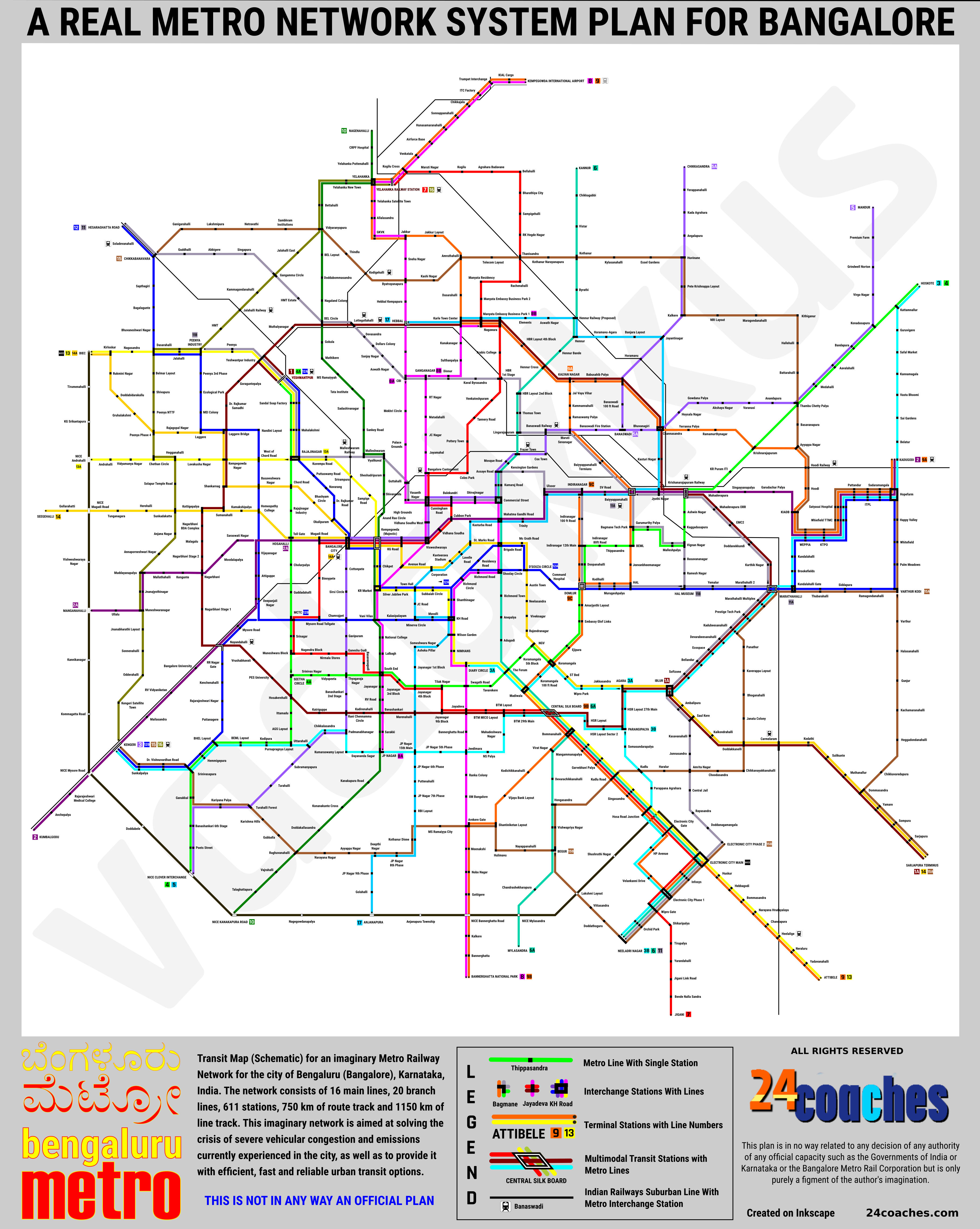
Oh yeah. That, my friends, is a concept of how a REAL intra-city mass urban transit system looks like. A 16 line system of 6-car Metro railway systems snaking across the city, dipping into catchment areas of all kinds across and around the city, delivering riders to where they want in the time they need. Shocked? Surprised? Flabbergasted? Yes, each line in that imaginary multicolored maze represents a Metro train line that could enable fast, easy, efficient, reliable, predictable and comfortable transit for us, the people of Bangalore, freeing us from the frustrations, inefficiency, unreliability and slowness of cars and traffic. Just go through the map and imagine the possibilities of you not having to wait at signals and get blocked by never-ending streams of vehicles, zipping from station to station unhindered by blockages and free of dust, pollution and delays, above or below stranded people in their vehicles, getting where you want in time what you want, arriving exactly at the time when you planned you would, with travel times taking only a little over an hour end-to-end even on the longest line! Of course, this plan is not perfect, a professional urban transport/transit planner or transit map designer will be able to find a lot of mistakes in there. But hey, I am not a professional, though I wish I were! 🙂

You can also download the map above in PDF! (784 kb)

You can also also see the routes of the lines as they would exist in real life on a Google Map:

This plan for a Bangalore Metro network consists of around 750 kilometers of railway track across the city, on which around color-coded 16 main lines and their 20 branch lines run 1150 kilometers of services using 6-car light rail trainsets, serving 611 stations, 65 of them interchange stations, and 12 of those multimodal transit stations. It will serve 15 railway stations including Majestic, Yeshwantpur and Yelahanka, the Airport and innumerable bus stations and bus stops. Compared to the present plan which is 48 kilometers of track and 47 km of route length, with 4 main lines and no branch lines will run serving 101 stations, including 3 railway stations only. And this of course will be the biggest Metro system in the world! The current biggest is the Shanghai Metro with 588 km of system track length. Some might say this is overkill for a city like Bangalore, but no, it is not. We should learn to grow out of our shells of “this is good enough for us” humility and dream big, really big. Why shouldn’t we really be the best in the world, today, as opposed to being good only at chest thumping about how good we were in the past?

The system makes good use of the concept of branch lines. Branch lines are formed when the line splits at a station into two lines. The train coming from the originating station might go to any of the two destinations served by the branch line. The Blue Line of the Delhi Metro is an example. Here, taking the Orange line 9 as an example, the train coming from its origin at KIAL as no.9 will follow its “main” route until Attibele, while 9A will go to Kadugodi diverting from Kalyan Nagar. The 9B line will run on the route of 9 until Silk Board, where it will divert to Bannerghatta National Park. In the same way, train coming from either Attibele or BNP as the can also terminate at at Indiranagar as the 9C line. Yeah, something akin to BMTC’s confusing route-numbering (lettering) which Bangaloreans are no strangers to. “This branch line” method provides much better flexibility in connectivity than individual lines, avoids duplication of routes and lines, prevents operational overheads and enables maximum and efficient utilization of tracks and rakes. The branch line system has been employed in many systems across the world, but this will be the largest one ;). This entire system will need a plethora of depots, control centers, offices, residential quarters and so on, and in many ways, directly and indirectly, Bangalore Metro Rail Corporation will become one of the biggest employers in the city.

You can go through the maps which are pretty much self explanatory and see all the options and ways you can utilize it. To make it more clearer, here are the lines of the system and how they pan out. Click on the heading and color of the line you want to see details of. You can compare that with the map above.

The Lines of My Imaginary Bangalore Metro Network

1 | 1A Yeshwantpur - Yeshwantpur | Sarjapura Terminus

The Crimson Line 1 should've been "Namma Metro's" Phase II in real life, instead of the other two cross-city lines that are being planned. This line draws a ring around the city, following the Outer Ring Road for most of its route. It starts at Yeshwantpur Railway station and goes on connecting all of the outer ring road with its IT and residential areas: BEL, Hebbal, Nagawara, Banaswadi, KR Puram Railway Station, Marathahalli, the ORR IT Corridor, HSR Layout, Silk Board, BTM, JP Nagar, Banashankari, Mysore Road, Nagarbhavi, Laggere and Peenya, ending at Yeshwantpur. It also has a branch line (1A) connecting Sarjapur Road to Silk Board, BTM, and onwards. It crosses all other 16 lines except the Brown peripheral line (15). This one line alone will solve around 30% of Bangalore's traffic problems.

Crimson Line 1 Route and Stations: Yeshwantpur, Yeshwantpur Industry, Muthalyanagar, BEL Circle, Lottegollahalli, Hebbal, Karle Town Center, Mantyata Embassy Business Park 1, Nagwara, HBR Layout 4th Block, Hennur Cross, Kalyan Nagar, Babusahib Palya, Banaswadi Outer Ring Road, Channasandra, Kasturi Nagar, Krishnarajapuram Railway, Mahadevapura ORR, EMC2, Doddanekkundi, Karthik Nagar, Marathahalli, Marathahalli Multiplex, Prestige Tech Park, Kadubeesanahalli, Devarabeesanahalli, Ecospace, Bellandur, Softzone, Iblur, Agara, HSR Layout 27th Main, HSR Layout 2nd Sector, Parangipalya, HSR Layout, Central Silk Board, BTM Layout 29th Main, BTM Layout, BTM MICO Layout, Jayadeva, Jayanagar 9th Block, Marenahalli, Banashankari, Kadirenahalli, Katriguppe, Saptagiri Nagar, PES University, Vrishabhavati, Nayandahalli, Nagarbhavi Stage 1, Nagarbhavi, Nagarbhavi Stage 2, Malagalu, Nagarbhavi BDA Complex, Kottigepalya, Sumanahalli, Shankarnag, Kempegowda Nagar, Laggere Bridge, Dr. Rajkumar Samadhi, Goraguntepalya, Yeshwantpur Industry, Yeshwantpur. Crimson Branch Line 1A: Iblur, Ambalipura, Saul Kere, Kaikondrahalli, Doddakanelli, Carmelaram, Kodathi, Sulikunte, Muthanallur, Dommasandra, Yamare, Sompura, Sarjapura, Sarjapura Terminus.
2 | 2A Kadugodi - Kumbalagodu | Manganahalli

The Purple Line 2 which is also the first Namma Metro line has been left as it is in the "real life" plan, connecting Kadugodi (Whitefield Railway Station) to ITPL, KR Puram, Indiranagar, MG Road, Majestic / Bangalore City Railway station, Vijayanagar, Mysore Road and Kengeri, but in this plan it has been extended to Kumbalagodu. It also has a branch line (2A) from just before Vijayanagar station which goes to Nagarbhavi and on to the Western ends of Bangalore. This is will give the Nagarbhavi region direct connectivity to the central and eastern parts of the City. From Kadugodi, one in every three services should be one via the branch line. It will be one of the most heavily utilized lines as it runs across the city connecting some of its most important and highly traveled areas, especially as it connects the Whitefield IT areas with Indiranagar, MG Road and Majestic. It will run parallel to the suburban railway line, connecting three major railway stations on the way as well, transit passengers to/from which will form a major chunk of the passengers.

Purple Line 2 Route and Stations: Kumbalgodu, Anchepalya, Rajarajeshwari Nagar Medical College, NICE Mysore Road, Kengeri, Mailasandra, RV Vidyaniketan, Bangalore University, Nayandahalli, Mysore Road, Deepanjali nagar, Attiguppe, Vijayanagar, Hosahalli, Magadi Road, Bangalore City, Kempegowda (Majestic), KG Road, Vishweshwaraiah, Vidhana Soudha, Cubbon Park, Mahatma Gandhi Road, Trinity, Ulsoor, Indiranagar, Swami Vivekananda Road, Baiyyappanahalli, Jyotipuram, Krishnarajapuram Railway, Mahadevapura, Siggayanapalya, Garudacharpalya, KIADB, WEPPIA, KTPO, Whitefield TTMC, Satyasai Hopital, Pattandur, ITPL, Sadaramangala, Hopefarm, Kadugodi. Purple Branch Line 2A: Sawaswati Nagar, Moodalapalya, Nagarbhavi, Kengunte, Mallathahalli, Muddayanapalya, Jnanajyothinagar, Muneshwaranagar, Ullalu, Manganahalli.
3 | 3A | 3B Hoskote - Kengeri | Neeladri Nagar | Diary Circle

The Aqua Line 3 is the through and through IT Metro line. Connects 56 Stations from Kengeri and Uttarahalli to JP Nagar, BTM, HSR and the IT corridor along the outer ring road and onwards to KTPO and ITPL to Kadugodi and on to Hoskote. It runs though the heart of the most congested and frequently commuted routes in Bangalore from BTM to ITPL. It will also serve the interiors of BTM layout, namely 16th main and NS Palya which have large concentrations of IT employees. No longer have employees from Rajarajeshwari Nagar, Uttarahalli etc travel hours to get to these "IT areas". People coming in from Mysore and beyond on (suburban) trains and buses can take this line to seamlessly get connected to all these areas. A branch line runs from ITPL/ORR to Electronic City diverting from Agara via Somasundara Palya, which is a new apartment-dense boomtown south of HSR layout, providing ITPL-Electornic City Metro connection. The second branch runs towards Koramangala and Diary Circle from Agara, connecting ORR/ITPL with Koramangala. This will be without doubt the most crowded Metro line and requires a train running every two minutes during peak hours.

Aqua Line 3: Hoskote, Kattamnallur, Guruvigere, Safal Market, Kannamangala, Vastu Bhoomi, Sai Gardens, Belatur, Kadugodi, Sadaramangala, ITPL, Pattandur, Satyasai Hospital, Whitefield TTMC, KTPO, WEPPIA, Brookefields, Kundalahallli, Marathahalli, Marathahalli Multiplex, Prestige Tech Park, Kadubeesanahalli, Devarabeesanahalli, Ecospace, Bellandur, Softzone, Iblur, Agara, HSR Layout 27th Main, HSR Layout 2nd Sector, Parangipalya, HSR Layout, Central Silk Board, BTM Layout 29th Main, BTM Layout, BTM Layout 16th Main, NS Palya, Jeedimara, JP Nagar 5th Phase, JP Nagar 15th Main, JP Nagar, Dayananda Sagar, Kumaraswamy Layout, Chikkalasandra, Uttarahalli, Subramanyapura, Turahalli, Turahalli Forest, Kariyana Palya, Banashankari 6th Phase, Poets Street, NICE Clover Interchange. Aqua Branch Line 3A: Parangipalya, Somasundarapalya, Kudlu, Parappana Agrahara, Hosa Road Junction, Electronic City Gate, HP Avenue, Velankanni Drive, Electronic City Phase 1, Wipro Gate, Orchid Park, Neeladri Nagar. Aqua Branch Line 3B: Agara, Jakkasandra, Wipro Park, Koramangala ST Bed, Koramangala, Koramangala 100ft Road, Madiwala, The Forum, Diary Circle.
4 | 4A Hoskote - NICE Clover Interchange | Yeshwantpur

The Lime Line 4 runs across Bangalore, connecting the "real Bengaluru" areas like Vidyapeeta, T Nagar, Basavangudi, Jayanagar, Koramangala, Domlur and Indiranagar, including the 12th Main, 80ft Road and Thippasandra with each other, and also apartment-dense Kaggadasapura. It also covers two tech parks, EGL and Bagmane Tech Park, giving connectivity to many people working in these places. It also connects all these with Krishnarajapuram and Hoskote, one of the most densely traveled suburban routes. This line bypasses all CBD areas and will cater equally to social crowds and office-goers. It will also provide a host of interchange options to all areas. A branch line gives exclusive connectivity to areas like Rajarajeshwari Nagar, Hosakerehalli, Ittamadu, Srinagar via interchanges and onwards to Mysore Road, Magadi Road, Rajajinagar, Yeshwantpur and Chord Road.

Lime Line 4 Route and Stations: Hoskote, Kattamnallur, Kondasapura, Bandapura, Avalahalli, Medahalli, Thambuchetty Palya, Krishnarajapuram, KR Puram ITI, Krishnarajapuram Railway, Ashwin Nagar, Kaggadasapura, Vignan Nagar, Malleshpalya, Gurumurthy Palya, Bagmane Tech Park, BEML, Thippasandra, Indiranagar 80 feet Road, Indiranagar 12th Main, Doopanahalli, Domlur, Amarjyothi Layout, Embassy Golf Links Business Park, Ejipura, Koramangala, National Games Village, Koramangala 5th Block, The Forum, Tavarekere, Swagath Road, Tilak Nagar, Jayanagar 4th Block, Jayanagar 3rd Block, South End, Basavanagudi, Thyagaraja Nagar, Vidyapeeta, Srinivas Nagar, Seetha Circle, Saptagiri Nagar, Ittemadu, Hosakerehalli, Purnapragnya Layout, Kodipura, BEML Layout, BHEL Layout, Hemmigepura, Sriniavasapura, Ganakkal, Banashankari 6th Block, Poets Street, NICE Clover Interchange. Lime Branch Line 4A: Seetha Circle, Muneshwara Block, Srinagar, Mysore Road Satellite Bus Station, Guddadahalli, Cholurpalya, Magadi Road Toll Gate, Rajajinagar Industry, Chord Road, Rajajinagar, Mahalakshmi, Sandal Soap Factory, Yeshwantpur.
5 | 5A Mandur | Chikkasandra - NICE Clover Interchange

The Violet Line 5 runs from the newly developing northern areas of Bangalore beyond Banaswadi and the Outer Ring Road to the Western parts of the city around the Banashankari area, Uttarahalli, Rajarajeshwari Nagar and Kengeri via the old Cantonment areas, the Central Business District including Commercial Street, Shivajinagar, Vidhana Soudha, Majestic Railway Station, KR Market and Chamarajpet. The line splits into two at Banaswadi. It will also provide connection to Hoskote from Banaswadi (via the Lime line) bypassing KR Puram and the KR Market - Majestic - Shivajinagar connection. This will take a lot of BMTC buses off the roads.

Violet Line 5: Mandur, Premium Farm, Grindwell-Norton, Virgo Nagar, Kondasapura, Bandapura, Avalahalli, Medahalli, Thambuchetty Palya, Anandapura, Varanasi, Akshaya Nagar, Gowdana Palya, Hoysala Nagar, Channasandra, Bhuvanagiri, Banaswadi, Banaswadi Fire Station, Maruti Sevanagar, Banswadi Railway, Cox Town, Mosque Road, Frazer Town, Mosque Road, Assaye Road, Kamaraj Road, Commercial Street, Shivajinagar, Balekundri, Cunnigham Road, Vidhana Soudha West, Visweshwaraya, KG Road, Kempegowda (Majestic), Bangalore City, Cottonpete, Sirsi Circle, Chamrajpet, Gavipuram, Ganeshagudi, Thyagaraja Nagar, Banashankari 2nd Stage, Gururaja Layourt, Padmanabha Nagar, Chikkalasandra, Uttarahalli, Purnapragnya Layout, Kodipura, BEML Layout, BHEL Layout, Hemmigepura, Srinivasapura, Dr.Vishnuvardhan Road, Sunkalpalya, Kengeri. Violet Branch Line 5A: Chikkasandra, Yerappanahalli, Kada Agrahara, Angalapura, Huvinane, Pete Krishnappa Layout, Kalkere, Jayanti Nagar, Horamavu, Banaswadi Outer Ring Road, Banaswadi 100 ft Road, Banaswadi.
6 | 6A Kannur - Neeladri Nagar | Mylasandra

The Teal Line 6 is the no-nonsense line that runs straight from the northernmost suburbs of Kannur and Hennur to the Southern ends of Electronic City right through the heart of the city, including Commercial Street, MG Road, Brigade Road and Koramangala-Madiwala. It covers most of the places that people from Electronic City and thereabouts would like to go to the “City” for leisure, and will actually enable people living around the areas of Hennur etc to go work in Electronic City! OMG!! It has a branch line that runs from Bommanahalli, giving connectivity to Begur.

Teal Line 6 Route and Stations: Kannur, Chikkagubbi, Vistar, Kothanur, Byrathi, Hennur Railway, Hennur, Hennur Bande, Hennur Cross, HBR Layout 2nd Block, Thomas Town, Lingarajapuram, Frazer Town, Mosque Road, Assaye Road, Kamaraj Road, Commercial Street, Mahatma Gandhi Road, Brigade Road, Shoolay Circle, Richmond Town, Anepalya, Adugodi, The Forum, Madiwala, Central Silk Board, Bommanahalli, Mangammanapalya, Gavebhavipalya, Kudlu Road, Hosa Road Junction, Electronic City Gate, Electronic City Main, Infosys, Electronic City 1st Phase, Wipro Gate, Orchid Park, Neeladri Nagar. Teal Branch Line 6A; Central Silk Board, Bommanahalli, Virat Nagar, Devarachikkanahalli, Hongasandra, Vishwapriya Nagar, Begur, Chandrashekharapura, NICE Mylasandra, Mylasandra.
7 Yelahanka Railway Station - Jigani

The Red Line 7 is essentially two lines. One part running from Jigani to Majestic via Electronic City, BTM, Jayanagar and Mysore Road, and then to Yelahanka via Cantonment, Manyata and the upcoming residential corridors of North Bangalore like Thanisandra, RK Hegde Nagar, Bellahalli and Kogilu. It connects Jigani and areas around it, filled with apartments almost entirely populated by people working in Electronic City, and then Electronic City with BTM, Jayanagar and Basavanagudi, which will see largest travel volumes, and all of South Bangalore to the Satellite Bus Station which people from the area can use to go onwards to Mysore, Coorg and North Kerala. It also connects Manyata Tech Park directly with Majestic, a route on which even buses are not available now. There will be very few through travelers on this line. It has no branch lines.

Red Line 7: Yelahanka Railway Station, Kogilu Cross, Maruti Nagar, Kogilu, Agrahara Badavane, Bellahalli, Bharatiya City, Sampigehalli, Ramakrishna Hegde Nagar, Thanisandra, Rachenahalli, Manyata Residency, Manyata Embassy Business Park 2, Manyata Embassy Business Park 1, Nagawara, Arabic College, HBR 1st Stage, Venkateshpuram, Tannery Road, Pottery Town, Coles Park, Bangalore Cantonment, Cunningham Road, Balekundri, Cubbon Park, Vidhana Soudha, Visweshwaraya, KG Road, Kempegowda (Majestic), Magadi Road, Binnypete, Mysore Road Toll Gate, Mysore Road Satellite Bus Station, Srinagar, Muneshwara Block, Nagendra Block, Nirmala Stores, Ganesh Gudi, Basavanagudi, South End, Jayanagar 3rd Block, Jayanagar 4th Block, Tilak Nagar, Jayanagar 9th Block, Jayadeva, BTM MICO Layout, BTM Layout, BTM 29th Main, Central Silk Board, Bommanahalli, Mangammanapalya, Gavebhavipalya, Kudlu Road, Hosa Road Junction, Electronic City Gate, Electronic City Main, Infosys, Electronic City 1st Phase, Wipro Gate, Shikaripalya, Tirupalya, Yarandahalli, Jigani Link Road, Bende Nallasandra, Jigani.
8 | 8A | 8B KIAL | Manyata Tech Park 1 - JP Nagar | Bannerghatta National Park

The Pink Line 8 is another north-south line that starts from the Airport and then runs straight down to Hebbal and CBI, where it splits into two, the mainline going via RT Nagar and the branch line via Palace Grounds. They again meet at Cunningham Road, where where the mainline runs via Shivajinagar, MG Road, Richmond Road, Shantinagar and Diary Circle down BTM and Bannerghatta road until the BNP, connecting all these places with the Central Business District. The branch line bypasses Majestic to run via Avenue road and goes on to join the Green line to run until JP Nagar. A smaller branch line runs from Ganganagar to Manyata Tech Park, with the idea of connecting Bannerghatta Road and all of South Bangalore directly with Manyata, and also  and the Sultanpalya and RT Nagar areas where a lot of Manyata employees. This is in part the "Red" line that is planned to connect IIM Bangalore with Nagawara, though a lot more expansive, and also connects Shantinagar bus station. There is no use running it via Bannerghatta Road and the Hosur Road as planned now.

Pink Line 8: Kempegowda International Airport, KIAL Cargo, Trumpet Interchange, ITC Factory, Chikkajala, Sonnappanahalli, Hunasamaranahalli, Airforce Base, Venkatala, Kogilu Cross, Yelahanka Railway Station, Yelahanka, Yelahanka Satellite Town, Allalasandra, GKVK, Jakkur, Sneha Nagar, Byatrayanapura, Hebbal Kempapura, Hebbal, Bangalore Baptist Hospital, CBI, Ganganagar, RT Nagar, Matadahalli, JC Nagar, Jayamahal, Bangalore Cantonment, Cunningham Road, Balekundri, Shivajinagar, Commercial Street, Mahatma Gandhi Road, Brigade Road, Shoolay Circle, Richmond Road, Richmond Circle, Shantinagar, KH Road, Wilson Garden, NIMHANS, Diary Circle, Swagath Road, Jayadeva, JP Nagar 3rd Phase, Jeedimara, Ranka Colony, IIM Bangalore, Arekere Gate, Meenakshi, Nobo Nagar, Gottigere, NICE Banngerghatta Road, Kalkere, Bannerghatta, Bannerghatta National Park. Pink Branch Line 8B: CBI, Mekhri Circle, Palace Grounds, Guttahalli, Vasanth Nagar, Cunningham Road, Vidhana Soudha West, Visweshwaraya, Avenue Road, KR Market, Vani Vilas, National College, Lalbagh, South End, Jayanagar, RV Road, Banashankari, Sarakki, JP Nagar. Pink Branch Line 8B: Ganganagar, Dinnur, Sulthanpalya, Kanakanagar, Karle Town Center, Manyata Embassy Business Park 1.
9A | 9B | 9C KIAL | Indiranagar - Attibele | Kadugodi | Bannerghatta National Park

The Orange Line 9 is the sprawling "Tech Park Line", cutting right through Bangalore connecting all the biggest IT Parks in Bangalore except those on the Outer Ring Road: Manyata, Bagmane, EGL, KTPO/ITPL (Whitefield) and Electronic City, starting from the Airport and passing through Jakkur, running along the ring road and then through Kammanahalli, Baiyyappanahalli, HAL, Old Airport Road, Intermediate Ring Road, Koramangala, Madiwala, Silk Board and Hosur Road, going on to Attibele on the Tamil Nadu border via inside Electronic City. This one will be crammed with techies and startup entrepreneurs. A branch line continues to run via the Outer Ring Road and connects newly developed "techie" areas alike Hoodi and Ramamurthy Nagar with KTPO/ITPL. The other branch line runs directly from Koramangala to Indiranagar along Inner Ring Road and Indiranagar 100ft Road. A third branch line provides connectivity to the hugely congested areas lying between Bannerghatta Road and Hosur Road, connecting them to the rest of the city.

Orange Line 9: Kempegowda International Airport, KIAL Cargo, Trumpet Interchange, ITC Factory, Chikkajala, Sonnappanahalli, Hunasamaranahalli, Airforce Base, Venkatala, Kogilu Cross, Yelahanka Railway Station, Yelahanka, Yelahanka Satellite Town, Allalasandra, GKVK, Jakkur, Jakkur Layout, Amruthahalli, Dasarahalli, Karle Town Center, Manyata Embassy Business Park 1, Nagwara, HBR Layout 4th Block, Hennur Cross, Kalyan Nagar, Jal Vayu Vihar, Kammanahalli, Ramaswamy Palya, Maruti Seva Nagar, Baiyyappanahalli Terminus, Baiyyappanahalli, Bagmane Tech Park, BEML, Jeevanbheemanagar, HAL, Murugeshpalya, Kodihalli, Domlur, Amarjyothi Layout, Embassy Golf Links, Ejipura, Koramangala, Koramangala 100ft Road, Madiwala, Central Silk Board, Bommanahalli, Mangammanapalya, Gavebhavipalya, Kudlu Road, Hosa Road Junction, Electronic City Gate, HP Avenue, Velankanni Drive, Electronic City Phase 1, Infosys, Electronic City Main, Huskur, Hebbagodi, Bommasandra, Narayana Hrudayalaya, Chandapura, Heelalige, Neraluru, Yadavanahalli, Attibele. Orange Branch Line 9A: Kalyan Nagar, Babusahib Palya, Banaswadi Outer Ring Road, Channasandra, Yerranapalya, Ramamurthy Nagar, Krishnarajapuram, Ayyappa Nagar, Hoodi Railway, Hoodi, KIADB, WEPPIA, KTPO, Whitefield TTMC, Satyasai Hopital, Pattandur, ITPL, Sadaramangala, Hopefarm, Kadugodi. Orange Branch Line 9B: Domlur, Doopanahalli, Indiranagar 12th Main, Indiranagar 100ft Road, Indiranagar. Orange Branch Line 9C: Central Silk Board, Bommanahalli, Virat Nagar, Kodichikkanahalli, Vijaya Bank Layout, Shantiniketan Layout, Arekere Gate, Meenakshi, Nobo Nagar, Gottigere, NICE Banngerghatta Road, Kalkere, Bannerghatta, Bannerghatta National Park.
10 Nagenahalli - NICE Kanakapura Road

This Green Line 10 is partially different from the current Green line. It runs from areas north of Yelahanka to Majestic via Vidyaranyapura, BEL Circle, MS Ramaiyyah colleges, Sadashivanagar, Malleshwaram and Sheshadripuram and then to the deep southern areas of Bangalore, following the route of the current Green line via KR Market, Jayanagar, Banashankari and Talghattapura. It has no branches. This line runs for most of its run as a single line, alone and not combined with other lines. It also has the fewest interchanges.

Green Line 10 Routes and Stations: Nagenahalli, CRPF Hospital, Yelahanka Puttenahalli, Yelahanka, Yelahanka New Town, Bettahalli, Vidyaranyapura, BEL Layout, Doddabommasandra, Nagaland Colony, BEL Circle, Gokula, Mathikere, MS Ramaiyya, Tata Institute, Sadashivanagar, Sankey Road, Malleshwaram, Vyalikaval, Sheshadripuram, Shivananda, Anand Rao Circle, Kempegowda (Majestic), Chickpet, KR Market, Vani Vilas, National College, Lalbagh, South End, Jayanagar, RV Road, Banashankari, Sarakki, JP Nagar, Kanakapura Road, Konanakunte Cross, Doddakallasandra, Raghuvanahalli, Vajrahalli, Talaghattapura, NICE Kanakapura Road.
11 | 11A | 11B Neeladri Nagar - Hesaraghatta | Baiyyappahalli | Yeshwantpur

The Silver Line 11 is one of the most expansive Bangalore Metro lines which is both a IT commuter line and a CBD line. It runs through the entirety of Electronic City and then through the inside areas parallel to Hosur Road, emerging on Sarjapura Road to make a reversal at Iblur to run along the Outer Ring Road, connecting the apartment complexes on Sarjapur Road to both the Outer Ring Road and Electronic City. It will then turn left at Marathahalli, along the Old Airport Road and then through the densely populated of Basavanagar, Vignan Nagar and GM Palya, and onwards through Bagmane and Baiyyappanahalli to Banaswadi and HBR, crossing the Bellary Road and Outer Ring Road at BEL Circle, finally reaching Hesaraghatta on the other end of the city. One branch line runs straight from Marathahalli along the Outer Ring Road, sharing the ring road line's load. The idea is to connect KR Puram Railway station with Sarjapur Road, Electronic City and thereabouts, eliminating the hassle to get to KR Puram to board a train. The other more major branch line will run via Old Airport Road, Domlur, Indiranagar and Ulsoor to reach Shivajinagar and then crossing the new Airport Road to reach Malleshwaram and then onwards to Peenya. This branch provides cross-city connection from Malleshwaram and Chord Road etc with Shivajinagar, Indiranagar and Old Airport Road, and these with each other.

Silver Line 11 Routes and Stations: Neeladri Nagar, Orchid Park, Wipro Gate, Electronic City Phase 1, Infosys, Electronic City Main, Electronic City Phase 2, Doddamangala, Rayasandra, Central Jail, Amrita Nagar, Junnasandra, Kasavanahalli, Saul Kere, Ambalipura, Iblur, Softzone, Bellandur, Ecospace, Devarabeesanahalli, Kadubeesanahalli, Prestige Tech Park, Marathahalli Multiplex, Maratahalli, Marathahalli Market, Yemalur, HAL Museum, Ramesh Nagar, Basavanagar, Vignan Nagar, Malleshpalya, Gurumurthy Palya, Baiyyappanahalli, Baiyyappanahalli Terminus, Maruti Seva Nagar, Banaswadi Railway, Lingarajapuram, Thomas Town, HBR Layout 2nd Block, HBR First Stage, Kaval Byrasandra, Dinnur, Ganganagar, CBI, Ashwath Nagar, Sanjaynagar, Dollars Colony, Devasandra, Lottegollahalli, BEL Circle, HMT Estate, Gangamma Circle, Singapura, Abbigere, Guddahalli, Chikkabanavara, Soladevanahalli, Hesaraghatta. Silver Branch Line 11A: Marathahalli, Karthik Nagar, Doddanekkundi, EMC2, Mahadevapura ORR, Krishnarajapuram Railway, Jyothipuram, Baiyyappanahalli. Silver Branch Line 11B: HAL Museum, HAL, Murugeshpalya, Kodihalli, Domlur, Doopanahalli, Indiranagar 12th Main, Indiranagar 100ft Road, Indiranagar, Ulsoor, Kensington Gardens, Assaye Road, Kamaraj Road, Commercial Street, Shivajinagar, Balekundri, Cunningham Road, Vasanth Nagar, Guttahalli, Vyalikaval, Malleshwaram, Malleshwaram Railway, Rajajinagar, Mahalakshmi, Sandal Soap Factory, Yeshwantpur, Yeshwantpur Industry, Peenya, Peenya Industry.
12 | 12A | 12B Kundalahalli/ITPL - Hesaraghatta | Yeshwantpur | Rajarajeshwari Nagar

The Blue Line 12 or the Old Airport Road line runs through most of Bangalore’s most frequented non-ring road bus route: the 333/335 route, from ITPL/KTPO and Whitefield to Marathahalli, Old Airport Road, Brigade Road, Richmond Circle, Shantinagar bus station, KR Market, Chamrajpet and Mysore Road Satellite bus station, from where it runs back along with the Purple line and on towards the little-known North-western parts of Bangalore like Nandini Layout and Laggere, running cross through much of Peenya and then on towards Hesaraghatta. One branch line connects Rajarajeshwari Nagar with the CBD and Old Airport Road, while the other connects Old Airport Road to Majestic, and then to Yeshwantpur via Dr. Rajkumar Road and Rajajinagar. This line is a loop line, meaning that the Whitefield end will not have a terminus, but the train will keep running making a circle to and from Kundalahalli Gate via Whitefield, enabling people residing on the Whitefield Road areas (Varthur Kodi etc) to get to ITPL and WEPPIA and vice versa, while also serving the Old Airport Road. This will be a super-heavily traveled line and will run along a BRTS corridor that will start from Majestic and run via MG Road and Old Airport Road.

Blue Line 12 Routes and Stations: Kundalahalli, Brookefields, WEPPIA, KTPO, Whitefield TTMC, Satyasai Hopital, Pattandur, ITPL, Sadaramangala, Hopefarm, Happy Valley, Whitefield, Palm Meadows, Varthur Kodi, Ramagondanahalli, Siddapura, Thubarahalli, Kundalahalli, Maratahalli, Marathahalli Market, Yemalur, HAL Museum, HAL, Murugeshpalya, Kodihalli, Domlur, Command Hospital, D’Souza Circle, Mc Grath Road, Brigade Road, Residency Road, Richmond Circle, Shantinagar, KH Road, Mavalli, Minerva Circle, Kalasipalayam, Vani Vilas, Chamrajpet, Mysore Road Toll Gate, Mysore Road Satellite Bus Station, Deepanjali Nagar, Attiguppe, Vijayanagar, Homeopathy College, Basaveshwara Nagar, West of Chord Road, Nandini Layout, Laggere Bridge, Laggere, MEI Colony, Ecological Park, Peenya 3rd Phase, Peenya Industry, Jalahalli, Dasarahalli, Bhuvaneshwari Nagar, Bagalagunte, Saptagiri, Chikkabanawara, Soladevanahalli, Hesaraghatta. Blue Branch Line 12A: D’Souza Circle, Shoolay Circle, Richmond Road, Richmond Circle, Subbaiah Circle, Town Hall, Silver Jubilee Park, KR Market, Chikpet, Kempegowda (Majestic), Bangalore City, Okalipuram, Dr. Rajkumar Road, Navarang, Puttaswamy Road, Rajajinagar, Mahalakshmi, Sandal Soap Factory, Yeshwantpur. Blue Branch Line 12B: Mysore Road Satellite Bus Station, Mysore Road, Nayandahalli, RR Nagar Gate, Kenchenahalli, Rajarajeshwar Nagar, Pattanagare, BHEL Layout, Hemmigepura, Srinivasapura, Dr. Vishnuvardhan Road, Sunkalpalya, Kengeri.
13 | 13A Attibele - BIEC | Andhrahalli

The Yellow Line 13 runs on the route of the current Green line from BIEC to Majestic, from where it goes via KR Market and Shantinagar directly along the Hosur Road to Attibele along the route of the always overcrowded 365 series buses. It does not go inside Electronic City as it is mainly meant for people who commute to areas south of it. Direct connection from Yeshwantpur, Peenya and most of North-Western Bangalore to Madiwala, Silk Board, Hosur Road and Electronic City. An entirely proletariat commuter line. A branch line runs a straight line from the Westernmost reaches of Andhrahalli to Rajajinagar via Chord Road.

Yellow Line 13 Route and Stations: BIEC, Kirloskar, Nagasandra, Dasarahalli, Jalahalli, Peenya Industry, Peenya, Yeshwantpur Industry, Yeshwantpur, Sandal Soap Factory, Mahalakshmi, Rajajinagar, Kuvempu Road, Srirampura, Sampige Road, Kempegowda (Majestic), Chikpet, KR Market, Silver Jubilee Park, Town Hall, Subbaiah Circle, Shantinagar, KH Road, Wilson Garden, NIMHANS, Diary Circle, The Forum, Madiwala, Central Silk Board, Bommanahalli, Mangammanapalya, Gavebhavipalya, Kudlu Road, Hosa Road Junction, Electronic City Gate, Electronic City Main, Huskur, Hebbagodi, Bommasandra, Narayana Hrudayalaya, Chandapura, Heelalige, Neraluru, Yadavanahalli, Attibele. Yellow Branch Line 13A: Kuvempu Road, West of Chord Road, Kempegowda Nagar, Lavakusha Nagar, Hegganahalli, Chetan Circle, Vidyamanya Nagar, Andrahalli, NICE Andrahalli.
14 | 14A Sarjapura Terminus - Seegehalli | BIEC

The Gold Line 14 is the cross-city diagonal line from the South-East to the North-West. It runs along all of Sarjapura Road and then connects it with Koramangala and then the CBD: Lifestyle, Brigade Road, the posh areas of St.Marks Road and Lavelle Road, then to Corporation and Majestic, from where it goes on along Magadi Road to Seegehalli past the NICE Road interchange via Sunkadakatte. The branch line from Majestic runs along the sprawling northwestern areas of the city, along the ring road and past Laggere and Peenya to reach BIEC, connecting all these places directly to the CBD, Koramangala and Sarjapur Road. This enables people on Sarjapura Road to go places, especially those who commute long distances from the farthest reaches of Sarjapur Road to reach the city. It also connects Carmelaram Railway station with the city.

Gold Line 14 Route and Stations: Sarjapura Terminus, Sarjapura, Sompura, Yamare, Dommasandra, Muthanallur, Sulikunte, Kodathi, Carmelaram, Doddakkanelli, Kaikondrahalli, Saul Kere, Ambalipura, Iblur, Agara, Jakkasandra, Wipro Park, Koramangala ST Bed, Koramangala, National Games Village, Rajendranagar, Viveknagar, Neelasandra, Austin Town, D’Souza Circle, Mc Grath Road, Brigade Road, St.Marks Road, Lavelle Road, Kanteerava Stadium, Corporation, Avenue Road, KG Road, Kempegowda (Majestic), Bangalore City, Magadi Road, Magadi Road Toll Gate, Homeopathy College, Kamakshipalya, Sumanahalli, Kottigepalya, Sunkadakatte, Herohalli, Tunganagara, NICE Magadi Road, Gollarahatti, Seegehalli. Gold Branch Line 14A: Bangalore City, Okalipuram, Bhashyam Circle, Chord Road, Basaveshwara Nagar, Shankarnag, Kempegowda Nagar, Laggere Bridge, Laggere, Rajagopal Nagar, Peenya Phase 4, Gruhalakshmi, Doddabidarakallu, Rukmini Nagar, Kirloskar, BIEC.
15 | 15A Chikkabanavara - Kengeri | Sarjapura Terminus | Electronic City Phase 1

The brown or Chocolate Line 15 is a big "C", which along with the Olive line 16 will make a big circle around the peripheries of Bangalore. It is an epic line of 87 kilometers. It runs from Chikkabanavara and runs a half-moon around the city, and of course will only rarely run end-to-end, instead runs in pieces, though with the route number intact, unless it runs to its branch destinations. It will serve more as a transit line for people from the far flung areas of the city to get to their destinations, or for people on the outskirts including Yelahanka, Electronic City, Sarjapur Road, ITPL, JP Nagar, RR Nagar etc to get to other outskirts areas without having to cross or enter the city proper. The only place it goes to “inside” the city is Marathahalli, and will run as a parallel line to the Aqua and Silver lines to bring IT people to ORR and ITPL from the outskirts. On the other sides, it will connect the southern fringes of Bangalore directly between the NICE road and the Outer Ring Road and the newly developing dust bowls north of it. The 15A branch line will run to Sarjapur via Varthur and Gunjur, to solve all present traffic problems while also pre-preemptively solving any that may arise in the future, while also connecting Sarjapura proper directly with Electronic City. The 15B branch will connect all of south-western Bangalore and Begur directly with Electronic City.

Chocolate Line 15: Chikkabanavara, Ganigarahalli, Lakshmipura, Netravathi, Sambharam Institutes, Vidyaranyapura, Thindlu, Kodigehalli, Byatrayanapura, Kashi Nagar, Amruthahalli, Telecom Layout, Thanisandra, Kothanur Narayanapura, Kothanur, Kylasanahalli, Essel Gardens, Huvinane, Pete Krishnappa Layout, Kalkere, NRI Layout, Maragondanahalli, Kithiganur, Hallehalli, Battarahalli, Thambu Chetty Palya, Basavanapura, Ayyappa Nagar, Hoodi Railway, Hoodi, KIADB, WEPPIA, KTPO, Whitefield TTMC, Satyasai Hopital, Pattandur, ITPL, Sadaramangala, Hopefarm, Happy Valley, Whitefield, Palm Meadows, Varthur Kodi, Ramagondanahalli, Siddapura, Thubarahalli, Kundalahalli, Maratahalli, Marathahalli Multiplex, Prestige Tech Park, Kadubeesanahalli, Panathur, Kaverappa Layout, Bhoganahalli, Janata Colony, Doddakkanelli, Chikkanayakkanahalli, Choodasandra, Amrita Nagar, Haralur, Kudlu, Kudlu Road, Hongasandra, Vishwapriya Nagar, Begur, Nayappanahalli, Hulimavu, Shantiniketan Layout, Arekere Gate, MS Ramaiyya City, Kothanur Dinne, JP Nagar 8th Phase, Deepthi Nagar, Ayyappa Nagar, Narayana Nagar, Raghuvanahalli, Gubbala, Karishma Hills, Turahalli Forest, Kariyana Palya, Ganakkal, Srinivasapura, Dr. Vishnuvardhan Road, Sunkalpalya, Kengeri. Chocolate Branch Line 15A: Varthur Kodi, Varthur, Halasanahalli, Gunjur, Kachamaranahalli, Heggadondanahalli, Chikkavaderapura, Dommasandra, Yamare, Sompura, Sarjapura, Sarjapura Terminus. Chocolate Branch Line 15B: Begur, NICE Begur, Vittasandra, Doddathoguru, Neeladri Nagar, Orchid Park, Wipro Gate, Electronic City Phase 1, Infosys, Electronic City Main, Electronic City Phase 1.
16 Kengeri - Yelahanka Railway Station

The Olive Line 16 is mainly a connecting line that runs through areas not very well known to the poster parts of Bangalore, giving connectivity to the western-most areas of Bangalore. It starts from Kengeri and runs through the Jnanabharathi layout and upwards through Muddayanapalya and then through Sunkadakatte, Hegganahalli, through the heart of Peenya Industrial areas to reach Jalahalli and from there through the old HMT areas to reach Vidyaranyapura and Kengeri. It enables people to bypass all of the city to reach Kengeri from Yelahanka and for the western parts to reach the city through connecting lines.

Olive Line 16 Route and Stations: Kengeri, Kengeri Satellite Town, Oddrahalli, Sonnenahalli, Jnanabharathi Layout, Muneshwaranagar, Jnanajyothi Nagar, Muddayanapalya, Annapoorneshwari Nagar, Anjana Nagar, Sunkadakatte, Solapur Temple Road, Hegganahalli, Chetan Circle, Peenya Phase 4, Peenya NTTF, Shivapura, Belmar Layout, Peenya Dasarahalli, Jalahalli, Peenya Industry, HMT, Jalahalli Railway, Kammagondanahalli, Gangamma Circle, Jalahalli East, Vidyaranyapura, Bettahalli, Yelahanka New Town, Yelahanka, Yelahanka Railway Station.
17 Hebbal - Anjanapura

The idea behind the Sky Blue Line 17 is to solve a particularly annoying problem. The only way from North-Eastern Bangalore (Banaswadi, Kalyan Nagar, Kammanahalli, Hebbal, HBR, Horamavu area and ORR) to get to all of central and south Bangalore is via the narrow,perennially jammed Kasturi Nagar – NGEF – Baiyyppanahalli road. This line connects these two parts and also provides connectivity north of the ORR to areas like Horamavu, thereby reducing crowds on the ORR and the Crimson line, and also connects these areas to Indiranagar, MG Road, Corporation and Lavalle Road. It then turns into one of South Bangalore's own line, connecting JC Road (the only line) with Jayanagar, and then deep into the heart of South Bangalore, providing connectivity to the newly developed regions of JP Nagar 6th, 7th, 8th and 9th Phases. No branch lines.

Sky Blue Line 17 Route and Stations: Hebbal, Karle Town Center, Manyata Embassy Business Park 1, Elements, Ashwath Nagar, Hennur Railway, Hennur, Horamavu-Agara, Banjara Layout, Jayantinagar, Channasandra, Kasturi Nagar, Jyothi Nagar, Baiyyappanahalli, Indiranagar, Ulsoor, Trinity, Mahatma Gandhi Road, Kasturba Road, St.Marks Road, Lavelle Road, Kanteerava Stadium, Corporation, Town Hall, JC Road, Minerva Circle, Mavalli, KH Road, Wilson Garden, Someshwara Nagar, Ashoka Pillar, Jayanagar 1st Block, Jayanagar 4th Block, Marenahall, JP Nagar 15th Main, JP Nagar 6th Phase, Puttenahalli, JP Nagar 7th Phase, RBI Layout, Kothanur Dinne, JP Nagar 8th Phase, Deepthi Nagar, JP Nagar 9th Phase, Gollahalli, Anjanapura.
NICE Road Light Railway Line (BIEC - Electronic City Main)

The NICE Ring Road Light Railway will run from BIEC to Electronic City along the western and southern periphery of the city which are not very populated right now but will surely get filled up in the next five years, providing fast connectivity from Electronic City to the periphery and bypassing the city to reach all the major highways out of Bangalore. The NICE RRLR will be the lifeline to these areas, to which Metro Rail lines will feed and will also act as the end points of many lines,. The line can be constructed by NICE themselves along the NICE Road as India's first really private railway line, as they themselves own all the land along that area. Seamless interchange connectivity will be provided between Metro stations and NICE stations, which will also prominently feature entertainment options, shops etc.

NICE Road Light Railway Route and Stations: BIEC, Tirumenahalli, KG Srikantapura, NICE Andhrahalli, NICE Magadi Road, Vishweshwaraya Nagar, Manganahalli, Kannikanagar, Komagatta Road, NICE Mysore Road, Doddabele, NICE Clover Interchange, NICE Kanakapura Road, Nagergowdanapalya, Anjanapura, Anjanapura Township, NICE Bannerghatta Road, NICE Mylasandra, Lakshmi Layout, Shushruti Nagar, Electronic City Gate, Electronic City Main.

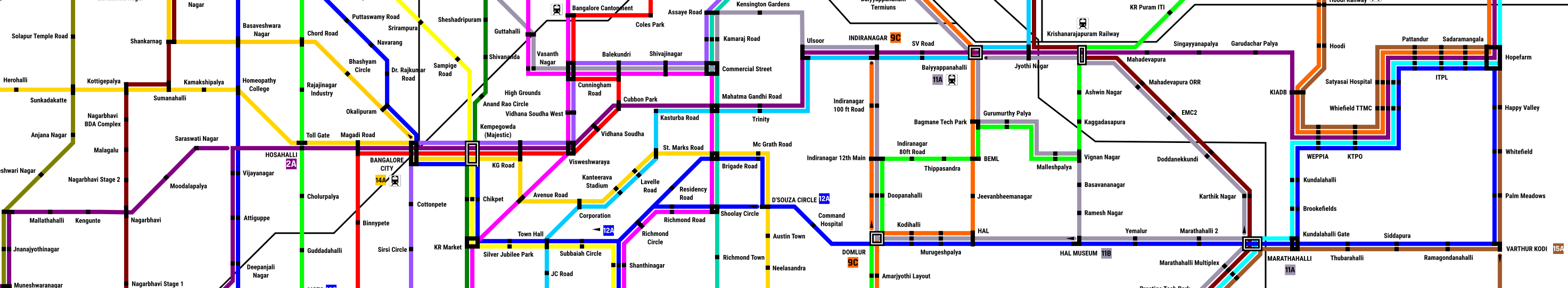
Some notes about stations that will come up in some of the most traffic intensive areas.

MANYATA TECH PARK: The five Metro lines that connect this humongous tech park of 1.5 lakh employees will run directly into the park, with two stations right inside the park and not just outside on the ring road, from which it will be only a 10 minutes walk to any office building in the park.

ELECTRONIC CITY: A station on the Hosur Road highway will not make any sense because Electronic City is largely spread out. It will have two tracks, one along the Infosys Main Road and another along the Velankanni Drive. While the Yellow line from Silk Board will run straight along Hosur Road, the Orange line will enter the area coming in from Attibele to enable employees from south of E-City to reach their offices directly. The stations are are E-City Gate, E-City Main (Hosur Road), Infosys Main Gate, Wipro Main Gate, In front of (E-City Phase 1) and terminal at Neeladri Nagar with all its apartments. The Red line will further go towards Jigani running on a route with more apartment buildings. Electronic City Phase 2 will have a station with two lines.

WHITEFIELD: WEPPIA (in front of SAP), KTPO (a bit further from i-Gate), Whitefield TTMC (Vydehi), Satyasai Hospital, Pattandur (just before erstwhile Big Bazaar), IPTL and Sadaramangala (GR Tech Park) are the stations. there wouldn’t be a need for a station at Graphite India junction as the WEPPIA station can service that area. This will be enough for optimum access to all tech parks and offices in the area.

OUTLYING AREAS BEYOND THE OUTER RING ROAD: These “new” areas that have come up in the past five years such as Vidyaranyapura, Thanisandra, Hennur, Kothanur (North), Horamavu-Agara, Ramamurthy Nagar, TC Palya Main Road etc have been haphazardly developed with no planning at the whim of private developers, and are almost completely car dependent, populated by mostly IT employees and (ex-villager) locals. They have no proper facilites including roads and face debilitating girdlocks. Lines 5, 6, 7, 8, 9, 10, 15 and 17 have been designed to specifically connect these areas with the rest of the city, especially through interchanges (line 15), and major connections being to the Crimson “Ring Road” line.

AIRPORT: A doubt many people will almost immediately have is “why no dedicated Metro line to the Aiport?” The answer is that a Metro line dedicated to the airport is not feasible. The two lines, 8 and 9 which run to KIAL here are mainly aimed at serving people along the highway north of Yelahanka, and also workers who live around there and work at the airport, while also serving passengers to the airport. A dedicated Metro line to the airport would mean excluding all of those people. For airport lines to make sense, we need commuter rail that will enable high-speed, high-capacity transit to the airport and back, and not a Metro line, which won’t be able to handle all the luggage in the first place. A detailed post about this will come up later, but for now check out the A1-A4 “Airport Express” lines proposed in our Bangalore Suburban Railway system.

Bangalore Metro
Bangalore Metro

Bangalore Metro” by Amith Nag, Flickr | “Bangalore Metro” by ‘Sandflash, Flickr

What such a Metro Railway Network Can do

There is not need to explain the revolution in connectivity a network like this can bring. You live at Banaswadi and got an offer from a company in Electronic City? No sweat, Take the Violet line to Sevanagar (2-3 stops) and then the Orange line directly to E-City! You want to put your kids in a CBD school but live and work near Whitefield? No problem! Shift to Richmond Town and just take the Blue line! Your girlfriend studying at MS Ramaiyya and you stay in Jayanagar should no longer mean that you will have a long-distance relationship, thanks to the Green line! A Yelahanka native can easily get to her office at Vidhana Soudha on the Pink line or a factory worker from Katriguppe to their work place in Peenya on the Crimson line. Want to go shopping at Gandhi Bazaar Basavanagudi or Avenue Road on a Sunday from RT Nagar? The Pink line it is! And, there is no longer any worry of any hassle of you getting to a station or home to board or after alighting from a long-distance train or bus. Koramangala to Jayanagar (Lime line), Nandini Layout to ITPL (Blue line), Laggere to BTM Layout (Crimson Line), Shantinagar to Singasandra (Yellow Line) Hesaraghatta to Horamavu (Brown line), Peenya to Kengeri (Olive Line), Cantonment to Basavangudi (Red line), Frazer Town to Begur (Teal line), Jayanagar to MG Road (Sky Blue line) Kaggadasapura to Madiwala (Lime line), Bannerghatta Road to Manyata Tech Park (Pink line), Electronic City to Bagmane tech Park (Silver line), Sarjapur Road to Brigade Road (Gold line), Mysore Road to HSR Layout (Aqua Line) – Everything is possible! A Metro plan like this will liberate the city. Laggere, Peenya, Nagarbhavi, Andrahalli, Banashankari 6th Stage, Jnanabharathi, RR Nagar etc will no longer be disconnected backwaters anymore.

And it is not just connectivity. People will get far more time for themselves and to spend with their friends and families, pollution, dust and associated problems will come down, the city will get cooler, people will be less tired and of course, happier and healthier, the city will save millions on maintaining and building roads and infrastructure and on importing fuel and so on. Very simply put, everything will move faster in Bangalore. Our lives will have order in them, as we will know when and where we will reach in what time, thanks to the predictability of the network. It is not just people going to office, but everybody and everything. You will have time for a lot more things! The city will spread out more, people can live where they want to, without being tied down around their work places. Just like our brains, conditioned to slowness and delays and car-driving orgasms are unable to comprehend how a pan-India High Speed Railway network can change our lives, we will not be able to understand how a network like this can change our lives until we get one like this. People who have lived in Europe or Japan might understand.

About the Creation of this Network Plan and More

Though it seems like it, I did not construct this map by drawing a bunch of random lines across a map. This is the result of more than two years of work, of traveling and studying traffic patterns and commuting objectives of Bangaloreans, what they travel for, purposes of leisure, commercial, official and social. The crux of this plan is that the most traveled routes of Bangalore should be covered by a straight line, every part of the city should be connected to the two Central Business Districts, the Majestic and MG Road areas and then the four major “IT hubs” of Whitefield, Outer Ring Road corridor, Electronic City and Manyata Tech Park and all transit points (railway stations, bus stations) should be connected by at least one metro line. Being a radial or circular city unlike Mumbai which is linear, a Metro railway network for Bangalore should be more like a wheel, with circular networks bracing axial lines crossing the city. Consideration was most importantly given to lines that do (will) not have suburban rail connectivity. For instance, there is only one Yelahanka – Majestic line, the Green line, which again takes a circuitous route, and no lines from Yelahanka to Yeshwantpur or from Krishnarajapuram or Whitefield to Cantonment. For the high-density eastern and south-eastern parts of the city and the CBD, dominated by apartment buildings and large offices, lines are more clustered to provide more capacity and frequency, and for the western half of the city that mostly consists of individual houses and commercial areas, tracks are more spread out as single lines out to cater to maximum areas, hooking each other up at every other station providing interchange options. While planning this network, I came up with some philosophies that became the base of this design. There are given below, explanations for which will be given in the next chapter.

[box type =”shadow”]

Cover as much of the city as possible.

Provide seamless, same-station transit facilities.

Distribute lines as per catchment area population density.

Stations must be located in the middle of catchment areas.

Provide infinite number of route options though as many interchange stations as possible.

Provide commuters connectivity to the exact spot of their end destination, at least on one end.

[/box]

However, even a network like this does not solve everything. A Metro network, though will provide easy commute between given points will not alone ensure complete end-to-end connectivity, because Metro lines are still essentially trains which have to run on their grade separated right of way and hence cannot serve everywhere and everyone, especially Bangalore’s residential layouts with their famous grid-like layouts. This is where BMTC comes is, whose job will be to connect Metro stations with each other and to ends of the city through the “white” areas in the map, providing last-mile connectivity, along with electric-bus BRTS corridors. The Metro network might solve the issues of in-city connectivity, but it will still not solve the problem of high-density, high-speed suburban connectivity, because Metro trains are too slow and stop too frequently for long-distance and even through-city suburban connectivity, which is where the “Namma Railu” Bangalore suburban railway system comes in, which will carry high volumes of commuters through the city and to its far flung outskirts and suburbs at higher speeds. For instance a Metro train from Majestic to KR Puram might take around 35 minutes, while a suburban train (in the plan). could do that in 20 minutes. In addition, driving must be disincentivized with higher taxes and congestion charges. More about a completely interconnected, transit city will be explained in the next chapter.

metro map split

Of course, this plan, just like my Suburban Network plan before, will most probably remain a fantasy, because Indian cities are not governed independently but only as administrative units which are only a department under the state government, who have thousands of other things to deal with. Then there are all the powerful lobbies who would really not want to see a plan like this become reality, because it even if the earth is burned and the sun destroyed, they would only want to see their profits and power increase. Only nations that can free themselves from the clutches of caucuses that only want to forward their own selfish agendas and provide what the people really want have any hope of improvement. And a lot of people in the city, most of them rich and powerful will be against this plan. But when the common people see what a Metro line can bring after the current lines are complete, they would have to yield to demands. Building this line would mean the demolition of half the city, but what if Bangalore could be rebuilt around this plan, the “old ways” of the city demolished, the new rising up from the ashes of concrete dust? What if the Metro were to be used as a tool to create a well-planned, integrated city? Our ancestors had figured out how to build complicated cities with multi-storied buildings 5000 years ago, we surely can figure out how to do this! Most lines in the CBD and crowded older parts of the city could be planned underground and the remaining elevated. Interchange stations can be designed so that two trains will arrive at the same platform by means of points and crossings where the same viaduct splits into two in a kind of “Y-joint”, just like the regular railway, instead of building two levels just for two lines. More about designing such systems will be explained again, in the next chapter. And it is preposterous that the Karnataka government wants to build even more elevated roads that will only make things worse!!

A network like this was always a dream of mine, though not shared by many others, that Bangalore, or any other Indian city had a real, world-class public transportation network that will enable efficient and fast connectivity, freeing people from the prisons of their cars, so that they can do something far better with their time than stuck in traffic. It has been too long that we have been living shackled to cars and their inefficiencies. We need redemption, else we will all be dead, choked to death by our own cars. But will we get it? Public transport systems give cities the world over their identities and personalities, and if you look closely, efficient public transit systems are the hallmark of every great city in the world. The Subway makes New York City what it is, as the Tube/Underground and the double decker buses make London. Zurich, Stockholm, Munich, Berlin, Frankfurt, Madrid, Brussels, Moscow, Beijing, Shanghai, Seoul, Melbourne and of course, Tokyo, all are examples. Closer to home, though not very “efficient” in a European sense, the Mumbai Suburban Railway makes Mumbai what it is. Such a Metro system would make Bangalore really count among the greatest cities in the world with among the happiest people living in it. Though this will remain a dream, it is a dream worth dreaming of! Imagine, as John Lennon would say, all the people, sharing the city on the Metro. You might say I am a dreamer, but hopefully I am not the only one here for sure!
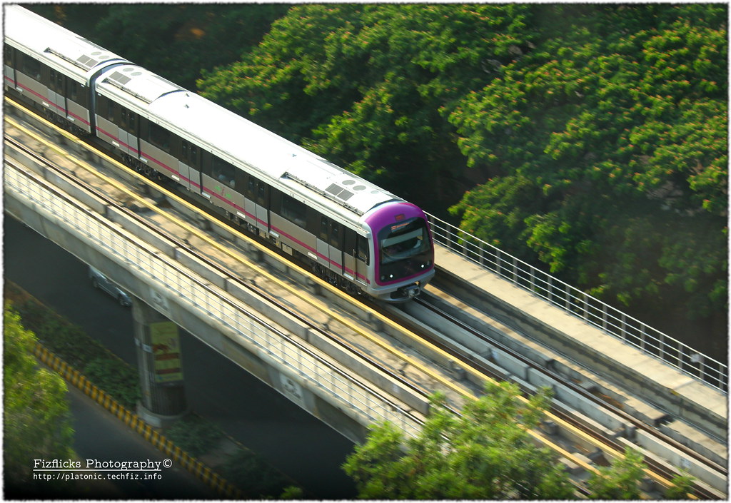
Namma Metro

Namma Metro” by Omshivaprakash HL | Fizflicks Photography

You Might also want to Read these in Conjunction with this Post:

A Suburban Railway Dream for Bangalore | Riding the Bangalore Metro Purple Line

0 0 votes
Article Rating
Subscribe
Notify of
guest
10 Comments
Inline Feedbacks
View all comments
Bangalorean
Bangalorean
6 years ago

Very good plan. However Govt is paying more attention to car and bikes manufacturing lobbyists.. They push for more and more fly-overs to make a city ugly and full of cars and bikes.

disqus_N5efFgX24h
disqus_N5efFgX24h
6 years ago

Very good plan but the saddest part is… it will take about 150 years to complete !!! for our “great” Indian govt. to realise the importance and start to do something!. For a simple single metro line the project is dragging dragging and dragging since 2011 !!! Just like that bullshit steel flyover idea these third-class goons get often, they will work against democracy for 20 to 30 years. By this time they would have “swindled” enough money from tax payer’s money as they usually do! and after 40 to 70 years they will get fed up and start listening to people and that too only after they realise that people have started kicking their behinds !!!!! it will take another 20 years to start the project and another 50 years to end the project !!!! kudos to a third-class country specially created by third-class politicians and people who support such third-class!. In this country a faithful tax payer has to fight till the end and “give up spirit” to achieve something so basic !!! truly third-class !!!

Dhruv J
Dhruv J
7 years ago

Great work done there! The thought is a great one to connect every corner of Bangalore, but I guess you’ve gone a bit too over on this one. The one noticeable error that I find in this plan is the bunching lines, just what happens to the BMTC routes as of today. Many corridors such as Bommanahalli-E gate have too many lines serving the exact same route and the interchanges thus won’t serve a great purpose. Trains would run partially full (around 25%) along these patches and a better way, I feel, to overcome these problems is to have a single line, designed for its own regions, instead of multiple lines stopping at the same stations. For example, a line passing through E city would have trains with 8 cars(rather than the proposed 6) and would have 3 pairs of doors each side (rather than the current 2) and would be of broad gauge to accommodate more passengers. Anyways, great work!

TSN
TSN
7 years ago

Excellent article. While I concur with you that this is a dream plan, I believe we have to make a start and refine things and build things as we go along. Great amount of work indeed, Thanks.

Shashidhar V
Shashidhar V
7 years ago

Very Good article , Karnataka & Central should implement this plan with feasibility checks , This is not a dream plan its a realistic plan , Shanghai & Beijing both have 588 and 554 KMs of Metro Rail network , Shanghai would have 800 KM metro length network by 2020 and Beijing would have close to 900 KM length , Bangalore would have max of may be 60-70 KM, We may only add extensions of phase 1 in phase 2 and new lines won’t be complete by 2020, Both the chinese cities would have min 730 KM advantage in 2020 .

It may take 50 years for Bangalore to be on par with the 2 Chinese cities , assuming the Chinese cities would slow down once they reach 1000+ KM in metro length

notpoliticallycorrect
7 years ago

Amazing work! Are you a professional in this field?

Bhavin
Bhavin
7 years ago

Ask yourself, not *can*, but do we need to afford it ?

IMHO, we’ll be well off if govt decided to connect the entire state with fiber internet & provided high speed WiFi hotspots.

Spending on infra really needs to be done/curtailed with serious prudence.

Back to top button
10
0
Would love your thoughts, please comment.x
()
x